 vesseltracker.com
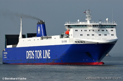
 HAFNIA SEA
Current Status
Where is the vessel?
HAFNIA SEA is currently in Near Agía Pelagía, based on AIS data received about 1h ago.
Latest AIS update:
Current position: 36.37893° N, 23.10053° E (Near Agía Pelagía)
Average speed (last 7 days): Loading…
Average speed (last 30 days): Loading…
Vessel profile: HAFNIA SEA is a Vehicles Carrier with dimensions m x m.
This page combines live AIS, route history, probable destination signals, nearby traffic, and port activity for practical vessel monitoring.
The current position of vessel HAFNIA SEA is 36.37893 lat / 23.10053 lng. Updated: 2026-05-02 14:24:42 UTCNearest reference points:
- Near Kythira
- 17 nm S of Areópolis
- 20 nm E of FOKIANOS
Currently sailing under the flag of Portugal ![]()
Details:
Live Vessel HAFNIA SEA Analytics (details, animations, etc.)
Recent AIS points (UTC):
2026-05-02 11:01:54 UTC · 36.60778, 21.83789 · SOG 19.8 kn · COG 116°2026-05-02 12:25:36 UTC · 36.41990, 22.34698 · SOG 19.7 kn · COG 114°
2026-05-02 13:40:54 UTC · 36.38933, 22.81835 · SOG 18.7 kn · COG 85°
2026-05-02 14:24:42 UTC · 36.37893, 23.10053 · SOG 19.1 kn · COG 96°