 vesseltracker.com
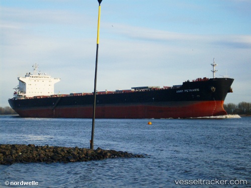
 Anny Petrakis
Current Status
Where is the vessel?
Anny Petrakis is currently in 214 nm E of Fort Dauphin, based on AIS data received less than 1h ago.
Latest AIS update:
Current position: 25.51500° S, 50.92500° E (214 nm E of Fort Dauphin)
Average speed (last 7 days): Loading…
Average speed (last 30 days): Loading…
Vessel profile: Anny Petrakis is a Bulk Carrier with dimensions 224m x 32m.
This page combines live AIS, route history, probable destination signals, nearby traffic, and port activity for practical vessel monitoring.
The current position of vessel Anny Petrakis is -25.51500 lat / 50.92500 lng. Updated: 2026-05-02 10:57:04 UTCNearest reference points:
- 271 nm E of Fort Dauphin
- 209 nm E of Manakara
- 194 nm E of Manakara
Currently sailing under the flag of Malta ![]()
Anny Petrakis built in 2008 year
Deadweight:
74500 tDetails:
Live Vessel Anny Petrakis Analytics (details, animations, etc.)
Recent AIS points (UTC):
2026-05-02 07:40:36 UTC · -25.82256, 50.33224 · SOG 11 kn · COG 58°2026-05-02 07:45:05 UTC · -25.81500, 50.34500 · SOG 11 kn · COG -1°
2026-05-02 09:54:07 UTC · -25.61833, 50.73667 · SOG 11 kn · COG -1°
2026-05-02 10:57:04 UTC · -25.51500, 50.92500 · SOG 11 kn · COG -1°