 vesseltracker.com
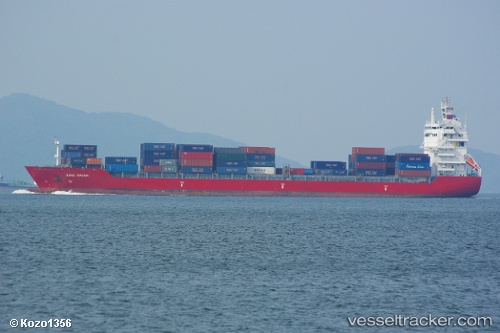
 HANSA LANKA
Current Status
Where is the vessel?
HANSA LANKA is currently in 46 nm W of Terempa, based on AIS data received about 1h ago.
Latest AIS update:
Current position: 3.44727° N, 105.48662° E (46 nm W of Terempa)
Average speed (last 7 days): Loading…
Average speed (last 30 days): Loading…
Vessel profile: HANSA LANKA is a Container Ship with dimensions 182m x 25m.
This page combines live AIS, route history, probable destination signals, nearby traffic, and port activity for practical vessel monitoring.
The current position of vessel HANSA LANKA is 3.44727 lat / 105.48662 lng. Updated: 2026-05-15 11:28:38 UTCNearest reference points:
- 39 nm SE of Belida Terminal
- 30 nm SW of Belanak Terminal
- 26 nm E of Belida Terminal
Currently sailing under the flag of Liberia ![]()
HANSA LANKA built in 2008 year
Deadweight:
24090 tDetails:
Live Vessel HANSA LANKA Analytics (details, animations, etc.)
Recent AIS points (UTC):
2026-05-15 08:20:54 UTC · 4.07833, 105.71167 · SOG 14 kn · COG -1°2026-05-15 10:20:54 UTC · 3.66833, 105.57000 · SOG 12 kn · COG -1°
2026-05-15 10:31:47 UTC · 3.63365, 105.55838 · SOG 12.4 kn · COG 200°
2026-05-15 11:28:38 UTC · 3.44727, 105.48662 · SOG 12.5 kn · COG 205°