 vesseltracker.com
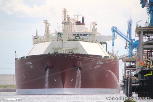
 Al Oraiq
Current Status
Where is the vessel?
Al Oraiq is currently in Near Cueva Bermeja, based on AIS data received less than 1h ago.
Latest AIS update:
Current position: 28.48228° N, 16.19285° W (Near Cueva Bermeja)
Average speed (last 7 days): Loading…
Average speed (last 30 days): Loading…
Vessel profile: Al Oraiq is a Lng Tanker with dimensions 315m x 50m.
This page combines live AIS, route history, probable destination signals, nearby traffic, and port activity for practical vessel monitoring.
The current position of vessel Al Oraiq is 28.48228 lat / -16.19285 lng. Updated: 2026-05-14 18:07:36 UTCNearest reference points:
- Near San Nicolás
- Near Las Galletas
- Near LOS CRISTIANOS
Currently sailing under the flag of Marshall Is ![]()
Al Oraiq built in 2007 year
Deadweight:
122079 tDetails:
Live Vessel Al Oraiq Analytics (details, animations, etc.)
Recent AIS points (UTC):
2026-05-14 14:04:33 UTC · 28.48226, -16.19274 · SOG 0.2 kn · COG 9°2026-05-14 15:37:32 UTC · 28.48263, -16.19243 · SOG 0.2 kn · COG 7°
2026-05-14 16:34:32 UTC · 28.48242, -16.19308 · SOG 0.3 kn · COG 32°
2026-05-14 18:07:36 UTC · 28.48228, -16.19285 · SOG 0 kn · COG 23°