 vesseltracker.com
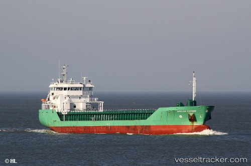
 HAV SUND
Current Status
Where is the vessel?
HAV SUND is currently in Near Molengat, based on AIS data received less than 1h ago.
Latest AIS update:
Current position: 53.06265° N, 4.41473° E (Near Molengat)
Average speed (last 7 days): Loading…
Average speed (last 30 days): Loading…
Vessel profile: HAV SUND is a General Cargo Ship with dimensions 90m x 15m.
This page combines live AIS, route history, probable destination signals, nearby traffic, and port activity for practical vessel monitoring.
The current position of vessel HAV SUND is 53.06265 lat / 4.41473 lng. Updated: 2026-05-14 17:26:02 UTCNearest reference points:
- Near Molengat
- Near Den Helder
- Near de Waal
Currently sailing under the flag of Faroe Islands ![]()
HAV SUND built in 2008 year
Deadweight:
4950 tDetails:
Live Vessel HAV SUND Analytics (details, animations, etc.)
Recent AIS points (UTC):
2026-05-14 14:05:14 UTC · 52.59333, 3.83167 · SOG 11 kn · COG -1°2026-05-14 16:06:26 UTC · 52.85866, 4.24050 · SOG 10.4 kn · COG 25°
2026-05-14 16:17:14 UTC · 52.88667, 4.26333 · SOG 10 kn · COG -1°
2026-05-14 17:26:02 UTC · 53.06265, 4.41473 · SOG 9.9 kn · COG 24°