 vesseltracker.com
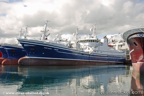
 Chris Andra
Current Status
Where is the vessel?
Chris Andra is currently in Near FRASERBURGH, based on AIS data received less than 1h ago.
Latest AIS update:
Current position: 57.69433° N, 1.99968° W (Near FRASERBURGH)
Average speed (last 7 days): Loading…
Average speed (last 30 days): Loading…
Vessel profile: Chris Andra is a Fish Carrier with dimensions 70m x 18m.
This page combines live AIS, route history, probable destination signals, nearby traffic, and port activity for practical vessel monitoring.
The current position of vessel Chris Andra is 57.69433 lat / -1.99968 lng. Updated: 2026-04-23 09:46:06 UTCNearest reference points:
- Near PETERHEAD
- Near Peterhead
- Near Aberdeen
Currently sailing under the flag of United Kingdom ![]()
Details:
Live Vessel Chris Andra Analytics (details, animations, etc.)
Recent AIS points (UTC):
2026-04-23 05:52:26 UTC · 57.69427, -1.99965 · SOG 0 kn · COG 357°2026-04-23 07:30:16 UTC · 57.69431, -1.99969 · SOG 0 kn · COG 357°
2026-04-23 07:34:26 UTC · 57.69431, -1.99970 · SOG 0 kn · COG 357°
2026-04-23 09:46:06 UTC · 57.69433, -1.99968 · SOG 0 kn · COG 357°