 vesseltracker.com
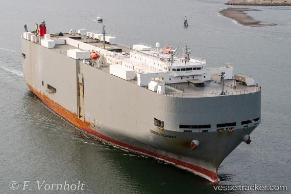
London Highway
Current StatusWhere is the vessel?
London Highway is currently in 79 nm N of Miramar, based on AIS data received about 2h ago.
Latest AIS update:
Current position: 10.87308° N, 79.09368° W (79 nm N of Miramar)
Average speed (last 7 days): Loading…
Average speed (last 30 days): Loading…
Vessel profile: London Highway is a Vehicles Carrier with dimensions 32m x 199m.
This page combines live AIS, route history, probable destination signals, nearby traffic, and port activity for practical vessel monitoring.
The current position of vessel London Highway is 10.87308 lat / -79.09368 lng. Updated: 2026-05-14 23:13:47 UTCNearest reference points:
- Near Colon
- Near COLON 2000
- Near Colón Free Zone
Details:
Live Vessel London Highway Analytics (details, animations, etc.)
Recent AIS points (UTC):
2026-05-14 19:12:06 UTC · 9.94344, -79.61171 · SOG 15.9 kn · COG 36°2026-05-14 21:50:14 UTC · 10.54490, -79.26413 · SOG 15.6 kn · COG 27°
2026-05-14 22:59:48 UTC · 10.81798, -79.12177 · SOG 15.8 kn · COG 24°
2026-05-14 23:13:47 UTC · 10.87308, -79.09368 · SOG 15.6 kn · COG 22°