 vesseltracker.com
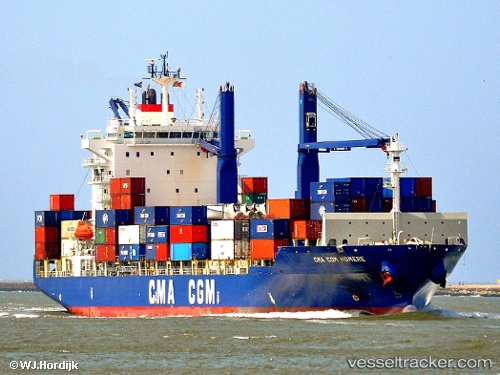
 CMA CGM HOMERE
Current Status
Where is the vessel?
CMA CGM HOMERE is currently in Near Ambrose Channel Light, based on AIS data received less than 1h ago.
Latest AIS update:
Current position: 40.47051° N, 73.86966° W (Near Ambrose Channel Light)
Average speed (last 7 days): Loading…
Average speed (last 30 days): Loading…
Vessel profile: CMA CGM HOMERE is a Container Ship with dimensions 170m x 27m.
This page combines live AIS, route history, probable destination signals, nearby traffic, and port activity for practical vessel monitoring.
The current position of vessel CMA CGM HOMERE is 40.47051 lat / -73.86966 lng. Updated: 2026-05-02 19:25:57 UTCNearest reference points:
- Near FORT HANCOCK
- Near Brooklyn
- Near Tompkinsville
Currently sailing under the flag of Indonesia ![]()
CMA CGM HOMERE built in 2007 year
Deadweight:
21264 tDetails:
Live Vessel CMA CGM HOMERE Analytics (details, animations, etc.)
Recent AIS points (UTC):
2026-05-02 16:44:10 UTC · 40.33832, -73.62027 · SOG 9.3 kn · COG 311°2026-05-02 17:26:30 UTC · 40.39561, -73.72500 · SOG 2.1 kn · COG 206°
2026-05-02 19:25:20 UTC · 40.46948, -73.86680 · SOG 14.1 kn · COG 295°
2026-05-02 19:25:57 UTC · 40.47051, -73.86966 · SOG 14.2 kn · COG 295°