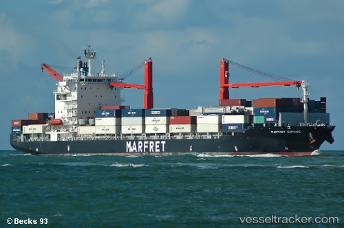
 MARFRET GUYANE
Current Status
Where is the vessel?
MARFRET GUYANE is currently in 31 nm N of Tela, based on AIS data received about 14h ago.
Latest AIS update:
Current position: 16.28483° N, 87.34183° W (31 nm N of Tela)
Average speed (last 7 days): Loading…
Average speed (last 30 days): Loading…
Vessel profile: MARFRET GUYANE is a Container Ship with dimensions m x m.
This page combines live AIS, route history, probable destination signals, nearby traffic, and port activity for practical vessel monitoring.
The current position of vessel MARFRET GUYANE is 16.28483 lat / -87.34183 lng. Updated: 2026-05-24 07:26:13 UTCNearest reference points:
- 26 nm SE of Dangriga
- 14 nm NW of Puerto Cortes
- 12 nm SW of Dangriga
Details:
Live Vessel MARFRET GUYANE Analytics (details, animations, etc.)
Recent AIS points (UTC):
2026-05-24 05:09:35 UTC · 16.53954, -86.89805 · SOG 13.4 kn · COG 238°2026-05-24 05:52:23 UTC · 16.46167, -87.04216 · SOG 13.4 kn · COG 235°
2026-05-24 07:26:13 UTC · 16.28483, -87.34183 · SOG 12.8 kn · COG 239°
2026-05-24 07:26:13 UTC · 16.28483, -87.34183 · SOG 12.8 kn · COG 239°