 vesseltracker.com
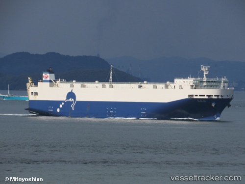
Housho Maru
Current StatusWhere is the vessel?
Housho Maru is currently in Near Mihama, based on AIS data received about 1h ago.
Latest AIS update:
Current position: 34.80615° N, 136.74902° E (Near Mihama)
Average speed (last 7 days): Loading…
Average speed (last 30 days): Loading…
Vessel profile: Housho Maru is a Vehicles Carrier with dimensions 28m x 165m.
This page combines live AIS, route history, probable destination signals, nearby traffic, and port activity for practical vessel monitoring.
The current position of vessel Housho Maru is 34.80615 lat / 136.74902 lng. Updated: 2026-05-14 07:53:07 UTCNearest reference points:
- Near Yokkaichi
- Near Kinuura
- Near Mihama
Details:
Live Vessel Housho Maru Analytics (details, animations, etc.)
Recent AIS points (UTC):
2026-05-14 04:26:12 UTC · 35.04563, 136.88315 · SOG 0 kn · COG 90°2026-05-14 06:29:12 UTC · 35.04558, 136.88318 · SOG 0 kn · COG 90°
2026-05-14 07:36:37 UTC · 34.89592, 136.75452 · SOG 19.8 kn · COG 183°
2026-05-14 07:53:07 UTC · 34.80615, 136.74902 · SOG 19.4 kn · COG 178°