 vesseltracker.com
 Hoheweg
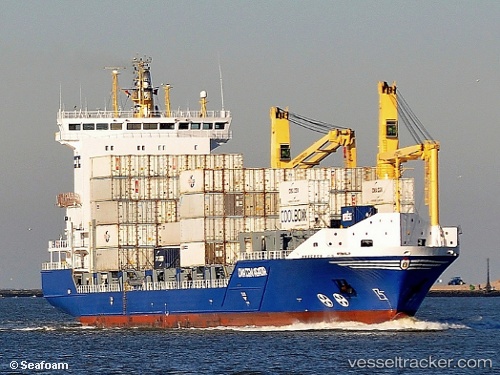
Current Status
Where is the vessel?
Hoheweg is currently in Near ALGER, based on AIS data received about 1h ago.
Latest AIS update:
Current position: 36.76480° N, 3.06707° E (Near ALGER)
Average speed (last 7 days): Loading…
Average speed (last 30 days): Loading…
Vessel profile: Hoheweg is a Container Ship with dimensions 139m x 23m.
This page combines live AIS, route history, probable destination signals, nearby traffic, and port activity for practical vessel monitoring.
The current position of vessel Hoheweg is 36.76480 lat / 3.06707 lng. Updated: 2026-04-13 05:38:56 UTCNearest reference points:
- Near Algiers
- 16 nm NE of Berja
- 17 nm S of Albanchez
Currently sailing under the flag of Antigua Barbuda ![]()
Hoheweg built in 2007 year
Deadweight:
11804 tDetails:
Live Vessel Hoheweg Analytics (details, animations, etc.)
Recent AIS points (UTC):
2026-04-12 23:30:50 UTC · 36.76483, 3.06705 · SOG 0 kn · COG 320°2026-04-13 01:26:54 UTC · 36.76482, 3.06704 · SOG 0 kn · COG 319°
2026-04-13 04:06:05 UTC · 36.76481, 3.06705 · SOG 0 kn · COG 320°
2026-04-13 05:38:56 UTC · 36.76480, 3.06707 · SOG 0 kn · COG 320°