 vesseltracker.com
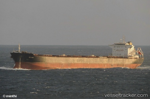
Petani
Current StatusWhere is the vessel?
Petani is currently in Near Bradwood, based on AIS data received less than 1h ago.
Latest AIS update:
Current position: 46.26199° N, 123.46935° W (Near Bradwood)
Average speed (last 7 days): Loading…
Average speed (last 30 days): Loading…
Vessel profile: Petani is a Bulk Carrier with dimensions 32m x 225m.
This page combines live AIS, route history, probable destination signals, nearby traffic, and port activity for practical vessel monitoring.
The current position of vessel Petani is 46.26199 lat / -123.46935 lng. Updated: 2026-05-14 10:08:24 UTCNearest reference points:
- Near Grays River
- Near Astoria
- Near WARRENTON
Details:
Live Vessel Petani Analytics (details, animations, etc.)
Recent AIS points (UTC):
2026-05-14 07:14:26 UTC · 46.26080, -123.46328 · SOG 0 kn · COG 272°2026-05-14 07:26:23 UTC · 46.26095, -123.46330 · SOG 0.1 kn · COG 276°
2026-05-14 09:32:18 UTC · 46.26196, -123.46919 · SOG 0 kn · COG 107°
2026-05-14 10:08:24 UTC · 46.26199, -123.46935 · SOG 0 kn · COG 116°