 vesseltracker.com
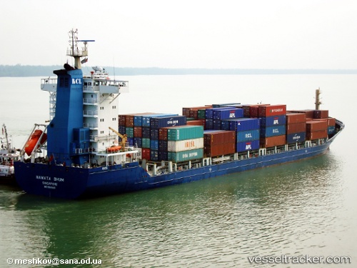
 Nawata Bhum
Current Status
Where is the vessel?
Nawata Bhum is currently in 16 nm SW of Banting, based on AIS data received about 1h ago.
Latest AIS update:
Current position: 2.66343° N, 101.25881° E (16 nm SW of Banting)
Average speed (last 7 days): Loading…
Average speed (last 30 days): Loading…
Vessel profile: Nawata Bhum is a Container Ship with dimensions 147m x 147m.
This page combines live AIS, route history, probable destination signals, nearby traffic, and port activity for practical vessel monitoring.
The current position of vessel Nawata Bhum is 2.66343 lat / 101.25881 lng. Updated: 2026-04-24 07:39:05 UTCNearest reference points:
- 15 nm SW of Banting
- 14 nm SW of Banting
- Near Pulau Indah
Currently sailing under the flag of Singapore ![]()
Nawata Bhum built in 2008 year
Deadweight:
13852 tDetails:
Live Vessel Nawata Bhum Analytics (details, animations, etc.)
Recent AIS points (UTC):
2026-04-24 00:41:49 UTC · 3.69520, 100.31320 · SOG 12.5 kn · COG 163°2026-04-24 05:06:24 UTC · 2.96078, 100.81077 · SOG 12.5 kn · COG 129°
2026-04-24 07:14:35 UTC · 2.70388, 101.18193 · SOG 12.5 kn · COG 118°
2026-04-24 07:39:05 UTC · 2.66343, 101.25881 · SOG 12.8 kn · COG 117°