 vesseltracker.com
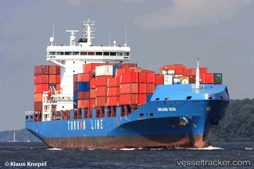
 ADMIRAL GALAXY
Current Status
Where is the vessel?
ADMIRAL GALAXY is currently in 25 nm N of Atakka Dry Port, based on AIS data received less than 1h ago.
Latest AIS update:
Current position: 32.50774° N, 33.04849° E (25 nm N of Atakka Dry Port)
Average speed (last 7 days): Loading…
Average speed (last 30 days): Loading…
Vessel profile: ADMIRAL GALAXY is a Container Ship with dimensions 183m x 28m.
This page combines live AIS, route history, probable destination signals, nearby traffic, and port activity for practical vessel monitoring.
The current position of vessel ADMIRAL GALAXY is 32.50774 lat / 33.04849 lng. Updated: 2026-04-20 01:21:04 UTCNearest reference points:
- 17 nm E of Atakka Dry Port
- 24 nm SW of Atakka Dry Port
- 16 nm N of Port Said
Currently sailing under the flag of Liberia ![]()
ADMIRAL GALAXY built in 2008 year
Deadweight:
26811 tDetails:
Live Vessel ADMIRAL GALAXY Analytics (details, animations, etc.)
Recent AIS points (UTC):
2026-04-19 21:05:50 UTC · 31.89407, 34.45034 · SOG 14 kn · COG 295°2026-04-19 21:05:50 UTC · 31.89407, 34.45034 · SOG 14 kn · COG 295°
2026-04-19 23:57:58 UTC · 32.36126, 33.38794 · SOG 14.3 kn · COG 297°
2026-04-20 01:21:04 UTC · 32.50774, 33.04849 · SOG 13.8 kn · COG 295°