 vesseltracker.com
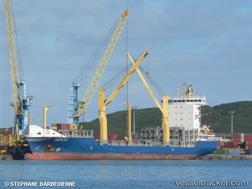
 HOHEPLATE
Current Status
Where is the vessel?
HOHEPLATE is currently in Near Port Laudania, based on AIS data received less than 1h ago.
Latest AIS update:
Current position: 26.07285° N, 80.12221° W (Near Port Laudania)
Average speed (last 7 days): Loading…
Average speed (last 30 days): Loading…
Vessel profile: HOHEPLATE is a Container Ship with dimensions m x m.
This page combines live AIS, route history, probable destination signals, nearby traffic, and port activity for practical vessel monitoring.
The current position of vessel HOHEPLATE is 26.07285 lat / -80.12221 lng. Updated: 2026-05-14 04:23:18 UTCNearest reference points:
- Near Dania Beach
- Near Port Everglades
- Near Fort Lauderdale
Currently sailing under the flag of Antigua and Barbuda ![]()
Details:
Live Vessel HOHEPLATE Analytics (details, animations, etc.)
Recent AIS points (UTC):
2026-05-14 01:39:57 UTC · 26.11494, -80.03081 · SOG 1.8 kn · COG 179°2026-05-14 02:14:56 UTC · 26.10451, -80.03827 · SOG 2 kn · COG 182°
2026-05-14 04:08:28 UTC · 26.07286, -80.12221 · SOG 0 kn · COG 92°
2026-05-14 04:23:18 UTC · 26.07285, -80.12221 · SOG 0 kn · COG 91°