 vesseltracker.com
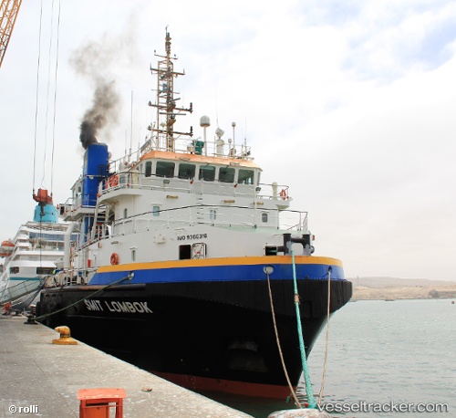
 NOMASA
Current Status
Where is the vessel?
NOMASA is currently in 11 nm NE of Tanga, based on AIS data received less than 1h ago.
Latest AIS update:
Current position: 4.91167° S, 39.22833° E (11 nm NE of Tanga)
Average speed (last 7 days): Loading…
Average speed (last 30 days): Loading…
Vessel profile: NOMASA is a Offshore Tug/Supply Ship with dimensions 16m x 60m.
This page combines live AIS, route history, probable destination signals, nearby traffic, and port activity for practical vessel monitoring.
The current position of vessel NOMASA is -4.91167 lat / 39.22833 lng. Updated: 2026-05-15 13:38:42 UTCNearest reference points:
- Near Mombasa
- 11 nm SE of Mombasa
- Near Dar Es Salaam
Currently sailing under the flag of South Africa ![]()
NOMASA built in 2006 year
Deadweight:
1833 tDetails:
Live Vessel NOMASA Analytics (details, animations, etc.)
Recent AIS points (UTC):
2026-05-15 09:33:25 UTC · -5.03945, 39.13813 · SOG 0.1 kn · COG 215°2026-05-15 10:17:39 UTC · -5.04333, 39.16833 · SOG 9 kn · COG -1°
2026-05-15 11:37:35 UTC · -4.95979, 39.18367 · SOG 0.2 kn · COG 170°
2026-05-15 13:38:42 UTC · -4.91167, 39.22833 · SOG 0 kn · COG -1°