 vesseltracker.com
 ERICUSA M
Current Status
Where is the vessel?
ERICUSA M is currently in 12 nm E of Dover, based on AIS data received less than 1h ago.
Latest AIS update:
Current position: 51.16270° N, 1.64432° E (12 nm E of Dover)
Average speed (last 7 days): Loading…
Average speed (last 30 days): Loading…
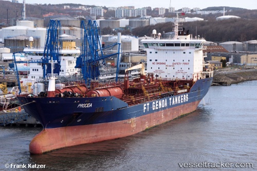
Vessel profile: ERICUSA M is a Chemical/Oil Products Tanker with dimensions 20m x 149m.
This page combines live AIS, route history, probable destination signals, nearby traffic, and port activity for practical vessel monitoring.
The current position of vessel ERICUSA M is 51.16270 lat / 1.64432 lng. Updated: 2026-05-17 19:32:02 UTCNearest reference points:
- 14 nm SE of RAMSGATE
- Near Sangatte
- 15 nm E of RAMSGATE
Currently sailing under the flag of Italy ![]()
ERICUSA M built in 2009 year
Deadweight:
17999 tDetails:
Live Vessel ERICUSA M Analytics (details, animations, etc.)
Recent AIS points (UTC):
2026-05-17 15:58:02 UTC · 51.76480, 2.41323 · SOG 11.4 kn · COG 222°2026-05-17 16:19:02 UTC · 51.71417, 2.34238 · SOG 11.6 kn · COG 218°
2026-05-17 18:07:41 UTC · 51.43423, 1.94310 · SOG 12.8 kn · COG 214°
2026-05-17 19:32:02 UTC · 51.16270, 1.64432 · SOG 15.7 kn · COG 235°