 vesseltracker.com
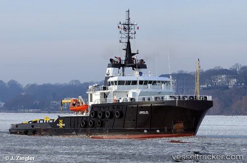
 BOKA FORWARD
Current Status
Where is the vessel?
BOKA FORWARD is currently in 194 nm NE of Sapiranga, based on AIS data received less than 1h ago.
Latest AIS update:
Current position: 27.51346° S, 22.29825° W (194 nm NE of Sapiranga)
Average speed (last 7 days): Loading…
Average speed (last 30 days): Loading…
Vessel profile: BOKA FORWARD is a Tug with dimensions m x m.
This page combines live AIS, route history, probable destination signals, nearby traffic, and port activity for practical vessel monitoring.
The current position of vessel BOKA FORWARD is -27.51346 lat / -22.29825 lng. Updated: 2026-05-13 23:56:13 UTCCurrently sailing under the flag of Malta ![]()
Details:
Live Vessel BOKA FORWARD Analytics (details, animations, etc.)
Recent AIS points (UTC):
2026-05-13 20:06:51 UTC · -26.96046, -21.88997 · SOG 10.1 kn · COG 215°2026-05-13 22:12:53 UTC · -27.26912, -22.10603 · SOG 10.6 kn · COG 217°
2026-05-13 22:18:11 UTC · -27.28224, -22.11575 · SOG 10.3 kn · COG 218°
2026-05-13 23:56:13 UTC · -27.51346, -22.29825 · SOG 10 kn · COG 216°