 vesseltracker.com
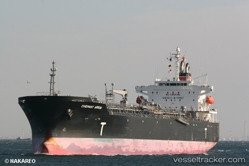
Chemway Arrow
Current StatusWhere is the vessel?
Chemway Arrow is currently in 78 nm SW of Uvita, based on AIS data received about 113d ago.
Latest AIS update:
Current position: 8.20768° N, 84.65674° W (78 nm SW of Uvita)
Average speed (last 7 days): Loading…
Average speed (last 30 days): Loading…
Vessel profile: Chemway Arrow is a Chemical Oil Products Tanker with dimensions 28m x 182m.
This page combines live AIS, route history, probable destination signals, nearby traffic, and port activity for practical vessel monitoring.
The current position of vessel Chemway Arrow is 8.20768 lat / -84.65674 lng. Updated: 2026-01-21 13:56:38 UTCNearest reference points:
- 67 nm SW of Sámara
- Near Golfo de Papagayo
- 27 nm W of Playa Conchal
Details:
Live Vessel Chemway Arrow Analytics (details, animations, etc.)
Recent AIS points (UTC):
2026-01-21 13:56:38 UTC · 8.20768, -84.65674 · SOG 13.4 kn · COG 118°