 vesseltracker.com
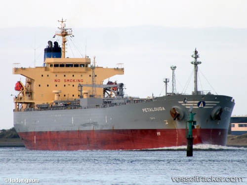
 Petalouda
Current Status
Where is the vessel?
Petalouda is currently in Near Ras Tannurah, based on AIS data received about 3h ago.
Latest AIS update:
Current position: 26.63496° N, 50.24749° E (Near Ras Tannurah)
Average speed (last 7 days): Loading…
Average speed (last 30 days): Loading…
Vessel profile: Petalouda is a Oil Products Tanker with dimensions 182m x 182m.
This page combines live AIS, route history, probable destination signals, nearby traffic, and port activity for practical vessel monitoring.
The current position of vessel Petalouda is 26.63496 lat / 50.24749 lng. Updated: 2026-05-15 00:11:23 UTCNearest reference points:
- Near Ad Dammam
- Near DAMMAM
- Near Sayhat
Currently sailing under the flag of Bahamas ![]()
Petalouda built in 2008 year
Deadweight:
47322 tDetails:
Live Vessel Petalouda Analytics (details, animations, etc.)
Recent AIS points (UTC):
2026-05-14 20:10:21 UTC · 26.63549, 50.24760 · SOG 0.1 kn · COG 311°2026-05-14 21:29:46 UTC · 26.63495, 50.24721 · SOG 0.1 kn · COG 334°
2026-05-14 22:26:27 UTC · 26.63501, 50.24730 · SOG 0 kn · COG 330°
2026-05-15 00:11:23 UTC · 26.63496, 50.24749 · SOG 0.1 kn · COG 325°