 vesseltracker.com
 DINA F
Current Status
Where is the vessel?
DINA F is currently in Near La Libertad, based on AIS data received less than 1h ago.
Latest AIS update:
Current position: 2.15769° S, 80.90670° W (Near La Libertad)
Average speed (last 7 days): Loading…
Average speed (last 30 days): Loading…
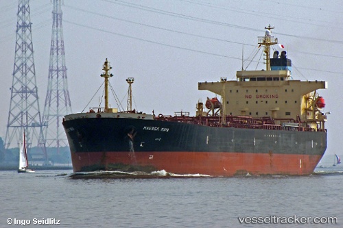
Vessel profile: DINA F is a Oil Products Tanker with dimensions 32m x 183m.
This page combines live AIS, route history, probable destination signals, nearby traffic, and port activity for practical vessel monitoring.
The current position of vessel DINA F is -2.15769 lat / -80.90670 lng. Updated: 2026-05-02 22:18:51 UTCNearest reference points:
- Near La Libertad
- Near Guayaquil
- Near Samborondon
Currently sailing under the flag of Liberia ![]()
DINA F built in 0 year
Deadweight:
0 tDetails:
Live Vessel DINA F Analytics (details, animations, etc.)
Recent AIS points (UTC):
2026-05-02 19:24:54 UTC · -2.15866, -80.90500 · SOG 0 kn · COG 265°2026-05-02 19:27:52 UTC · -2.15863, -80.90498 · SOG 0 kn · COG 264°
2026-05-02 21:27:53 UTC · -2.15758, -80.90678 · SOG 0.1 kn · COG 166°
2026-05-02 22:18:51 UTC · -2.15769, -80.90670 · SOG 0 kn · COG 165°