 vesseltracker.com
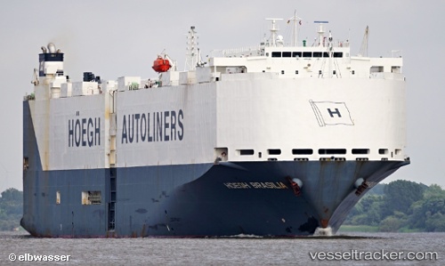
 VIKING BRASILIA
Current Status
Where is the vessel?
VIKING BRASILIA is currently in Near Atucha, based on AIS data received less than 1h ago.
Latest AIS update:
Current position: 34.55223° S, 58.30553° W (Near Atucha)
Average speed (last 7 days): Loading…
Average speed (last 30 days): Loading…
Vessel profile: VIKING BRASILIA is a Vehicles Carrier with dimensions m x m.
This page combines live AIS, route history, probable destination signals, nearby traffic, and port activity for practical vessel monitoring.
The current position of vessel VIKING BRASILIA is -34.55223 lat / -58.30553 lng. Updated: 2026-05-02 10:53:53 UTCNearest reference points:
- Near Dock Sur
- Near Avellaneda
- Near JUAN LACAZE
Currently sailing under the flag of Marshall Islands ![]()
Details:
Live Vessel VIKING BRASILIA Analytics (details, animations, etc.)
Recent AIS points (UTC):
2026-05-02 07:28:22 UTC · -34.23157, -58.78990 · SOG 8.1 kn · COG 125°2026-05-02 07:54:57 UTC · -34.24768, -58.71466 · SOG 9.1 kn · COG 104°
2026-05-02 09:42:42 UTC · -34.39189, -58.44857 · SOG 9.8 kn · COG 154°
2026-05-02 10:53:53 UTC · -34.55223, -58.30553 · SOG 10.8 kn · COG 136°