 vesseltracker.com
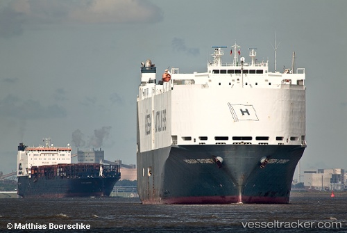
 VIKING SYDNEY
Current Status
Where is the vessel?
VIKING SYDNEY is currently in 19 nm NW of Tungprong Pt, based on AIS data received less than 1h ago.
Latest AIS update:
Current position: 12.86072° N, 100.54930° E (19 nm NW of Tungprong Pt)
Average speed (last 7 days): Loading…
Average speed (last 30 days): Loading…
Vessel profile: VIKING SYDNEY is a Vehicles Carrier with dimensions m x m.
This page combines live AIS, route history, probable destination signals, nearby traffic, and port activity for practical vessel monitoring.
The current position of vessel VIKING SYDNEY is 12.86072 lat / 100.54930 lng. Updated: 2026-05-14 18:14:55 UTCNearest reference points:
- Near NH Prosperity
- Near Tips Container Terminal
- Near KO SICHANG
Currently sailing under the flag of Marshall Islands ![]()
Details:
Live Vessel VIKING SYDNEY Analytics (details, animations, etc.)
Recent AIS points (UTC):
2026-05-14 14:18:30 UTC · 13.06515, 100.88139 · SOG 0 kn · COG 329°2026-05-14 15:30:25 UTC · 13.06511, 100.88140 · SOG 0 kn · COG 329°
2026-05-14 17:00:22 UTC · 13.05079, 100.74591 · SOG 15.2 kn · COG 253°
2026-05-14 18:14:55 UTC · 12.86072, 100.54930 · SOG 16.1 kn · COG 188°