 vesseltracker.com
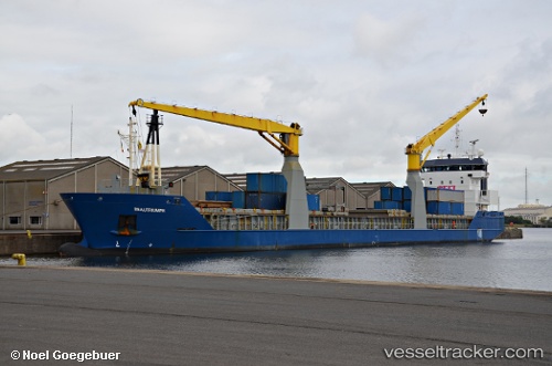
 ATALAYA TMA
Current Status
Where is the vessel?
ATALAYA TMA is currently in 33 nm NE of Verzy, based on AIS data received about 1h ago.
Latest AIS update:
Current position: 49.54300° N, 3.57323° W (33 nm NE of Verzy)
Average speed (last 7 days): Loading…
Average speed (last 30 days): Loading…
Vessel profile: ATALAYA TMA is a General Cargo Ship with dimensions 118m x 16m.
This page combines live AIS, route history, probable destination signals, nearby traffic, and port activity for practical vessel monitoring.
The current position of vessel ATALAYA TMA is 49.54300 lat / -3.57323 lng. Updated: 2026-04-28 18:07:09 UTCNearest reference points:
- 27 nm N of Verzy
- Near Verzy
- 12 nm S of Cornwall
Currently sailing under the flag of Spain ![]()
ATALAYA TMA built in 2008 year
Deadweight:
7218 tDetails:
Live Vessel ATALAYA TMA Analytics (details, animations, etc.)
Recent AIS points (UTC):
2026-04-28 13:47:16 UTC · 49.13063, -4.66331 · SOG 11.4 kn · COG 60°2026-04-28 15:35:11 UTC · 49.30073, -4.20141 · SOG 11.6 kn · COG 56°
2026-04-28 16:42:52 UTC · 49.41212, -3.91916 · SOG 11.3 kn · COG 58°
2026-04-28 18:07:09 UTC · 49.54300, -3.57323 · SOG 10.9 kn · COG 60°