 vesseltracker.com
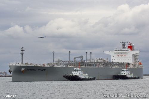
 Summit River
Current Status
Where is the vessel?
Summit River is currently in Near Kalbut Situbondo, based on AIS data received about 7h ago.
Latest AIS update:
Current position: 7.59274° S, 113.99454° E (Near Kalbut Situbondo)
Average speed (last 7 days): Loading…
Average speed (last 30 days): Loading…
Vessel profile: Summit River is a Lpg Tanker with dimensions 226m x 37m.
This page combines live AIS, route history, probable destination signals, nearby traffic, and port activity for practical vessel monitoring.
The current position of vessel Summit River is -7.59274 lat / 113.99454 lng. Updated: 2026-05-17 09:30:42 UTCNearest reference points:
- 30 nm NW of Sumenep
- Near Tanjung Perak
- Near Tanjong Perak
Currently sailing under the flag of Panama ![]()
Summit River built in 2008 year
Deadweight:
52991 tDetails:
Live Vessel Summit River Analytics (details, animations, etc.)
Recent AIS points (UTC):
2026-05-17 09:30:42 UTC · -7.59274, 113.99454 · SOG 1.6 kn · COG 310°2026-05-17 09:30:42 UTC · -7.59274, 113.99454 · SOG 1.6 kn · COG 310°
2026-05-17 09:30:42 UTC · -7.59274, 113.99454 · SOG 1.6 kn · COG 310°
2026-05-17 09:30:42 UTC · -7.59274, 113.99454 · SOG 1.6 kn · COG 310°