 vesseltracker.com
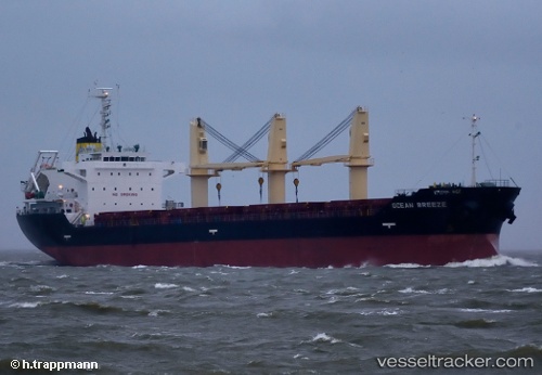
 OCEAN BREEZE
Current Status
Where is the vessel?
OCEAN BREEZE is currently in Near Drapetzona, based on AIS data received less than 1h ago.
Latest AIS update:
Current position: 37.95394° N, 23.60630° E (Near Drapetzona)
Average speed (last 7 days): Loading…
Average speed (last 30 days): Loading…
Vessel profile: OCEAN BREEZE is a Bulk Carrier with dimensions m x m.
This page combines live AIS, route history, probable destination signals, nearby traffic, and port activity for practical vessel monitoring.
The current position of vessel OCEAN BREEZE is 37.95394 lat / 23.60630 lng. Updated: 2026-05-16 09:22:49 UTCNearest reference points:
- Near Drapetzona
- Near Keratsínion
- Near Piraeus
Currently sailing under the flag of Antigua and Barbuda ![]()
Details:
Live Vessel OCEAN BREEZE Analytics (details, animations, etc.)
Recent AIS points (UTC):
2026-05-16 05:46:49 UTC · 37.95395, 23.60629 · SOG 0 kn · COG 115°2026-05-16 07:34:45 UTC · 37.95401, 23.60628 · SOG 0 kn · COG 115°
2026-05-16 08:22:46 UTC · 37.95397, 23.60630 · SOG 0 kn · COG 115°
2026-05-16 09:22:49 UTC · 37.95394, 23.60630 · SOG 0 kn · COG 115°