 vesseltracker.com
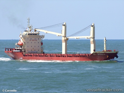
 DANUM MAS
Current Status
Where is the vessel?
DANUM MAS is currently in 79 nm SW of Bandanaira, based on AIS data received less than 1h ago.
Latest AIS update:
Current position: 5.09833° S, 128.69833° E (79 nm SW of Bandanaira)
Average speed (last 7 days): Loading…
Average speed (last 30 days): Loading…
Vessel profile: DANUM MAS is a General Cargo Ship with dimensions 117m x 20m.
This page combines live AIS, route history, probable destination signals, nearby traffic, and port activity for practical vessel monitoring.
The current position of vessel DANUM MAS is -5.09833 lat / 128.69833 lng. Updated: 2026-05-14 22:18:08 UTCNearest reference points:
- Near Ambon
Currently sailing under the flag of Indonesia ![]()
DANUM MAS built in 2007 year
Deadweight:
7709 tDetails:
Live Vessel DANUM MAS Analytics (details, animations, etc.)
Recent AIS points (UTC):
2026-05-14 19:27:09 UTC · -4.74500, 128.41499 · SOG 8 kn · COG -1°2026-05-14 19:57:09 UTC · -4.80167, 128.46667 · SOG 9 kn · COG -1°
2026-05-14 21:18:10 UTC · -4.97333, 128.59833 · SOG 9 kn · COG -1°
2026-05-14 22:18:08 UTC · -5.09833, 128.69833 · SOG 9 kn · COG -1°