 vesseltracker.com
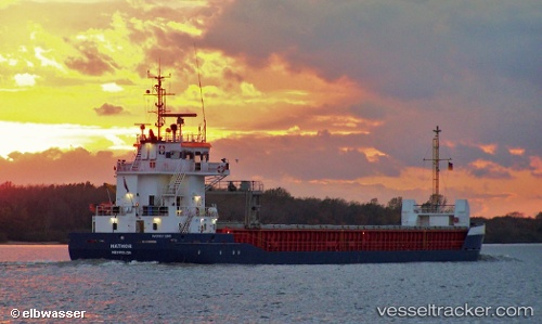
 Hathor
Current Status
Where is the vessel?
Hathor is currently in 22 nm SW of Ferrybridge, based on AIS data received less than 1h ago.
Latest AIS update:
Current position: 50.32382° N, 2.88754° W (22 nm SW of Ferrybridge)
Average speed (last 7 days): Loading…
Average speed (last 30 days): Loading…
Vessel profile: Hathor is a General Cargo Ship with dimensions 89m x 89m.
This page combines live AIS, route history, probable destination signals, nearby traffic, and port activity for practical vessel monitoring.
The current position of vessel Hathor is 50.32382 lat / -2.88754 lng. Updated: 2026-04-30 09:53:05 UTCNearest reference points:
- 16 nm SE of Brixham
- Near Castletown
- 23 nm NW of Saint Sampson
Currently sailing under the flag of Netherlands ![]()
Hathor built in 2007 year
Deadweight:
3850 tDetails:
Live Vessel Hathor Analytics (details, animations, etc.)
Recent AIS points (UTC):
2026-04-30 04:15:15 UTC · 50.48476, -1.67763 · SOG 10.1 kn · COG 260°2026-04-30 07:27:04 UTC · 50.44096, -2.34482 · SOG 6.7 kn · COG 263°
2026-04-30 08:03:45 UTC · 50.42975, -2.45881 · SOG 8 kn · COG 262°
2026-04-30 09:53:05 UTC · 50.32382, -2.88754 · SOG 10.8 kn · COG 248°