 vesseltracker.com
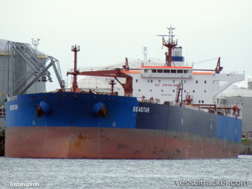
 Seastar
Current Status
Where is the vessel?
Seastar is currently in Near SOUVALA, based on AIS data received less than 1h ago.
Latest AIS update:
Current position: 37.84656° N, 23.52339° E (Near SOUVALA)
Average speed (last 7 days): Loading…
Average speed (last 30 days): Loading…
Vessel profile: Seastar is a Crude Oil Tanker with dimensions 250m x 44m.
This page combines live AIS, route history, probable destination signals, nearby traffic, and port activity for practical vessel monitoring.
The current position of vessel Seastar is 37.84656 lat / 23.52339 lng. Updated: 2026-04-28 00:18:06 UTCNearest reference points:
- Near AEGINA BOATYARD
- Near PERAMA
- Near Drapetzona
Currently sailing under the flag of Malta ![]()
Seastar built in 2008 year
Deadweight:
115639 tDetails:
Live Vessel Seastar Analytics (details, animations, etc.)
Recent AIS points (UTC):
2026-04-27 20:00:01 UTC · 37.84672, 23.52387 · SOG 0 kn · COG 21°2026-04-27 21:29:05 UTC · 37.84678, 23.52308 · SOG 0.1 kn · COG 32°
2026-04-27 22:36:07 UTC · 37.84713, 23.52274 · SOG 0.1 kn · COG 44°
2026-04-28 00:18:06 UTC · 37.84656, 23.52339 · SOG 0 kn · COG 24°