 vesseltracker.com
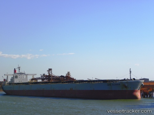
Cape Alliance
Current StatusWhere is the vessel?
Cape Alliance is currently in 71 nm SW of Gageohyangri, based on AIS data received less than 1h ago.
Latest AIS update:
Current position: 33.06160° N, 124.32041° E (71 nm SW of Gageohyangri)
Average speed (last 7 days): Loading…
Average speed (last 30 days): Loading…
Vessel profile: Cape Alliance is a Ore Carrier with dimensions 50m x 300m.
This page combines live AIS, route history, probable destination signals, nearby traffic, and port activity for practical vessel monitoring.
The current position of vessel Cape Alliance is 33.06160 lat / 124.32041 lng. Updated: 2026-05-15 18:00:16 UTCNearest reference points:
- 61 nm S of Gageohyangri
- 96 nm SW of Hwasun
- 117 nm NE of Jingjiang
Details:
Live Vessel Cape Alliance Analytics (details, animations, etc.)
Recent AIS points (UTC):
2026-05-15 14:12:58 UTC · 32.31610, 124.43226 · SOG 12.5 kn · COG 353°2026-05-15 15:46:07 UTC · 32.63610, 124.39261 · SOG 12.2 kn · COG 351°
2026-05-15 16:53:47 UTC · 32.85904, 124.36186 · SOG 11 kn · COG 346°
2026-05-15 18:00:16 UTC · 33.06160, 124.32041 · SOG 10.7 kn · COG 345°