 vesseltracker.com
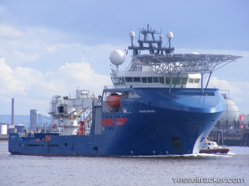
 OCEAN PROTECTOR
Current Status
Where is the vessel?
OCEAN PROTECTOR is currently in 32 nm W of ROTTNEST ISLAND, based on AIS data received about 76d ago.
Latest AIS update:
Current position: 31.79609° S, 114.96896° E (32 nm W of ROTTNEST ISLAND)
Average speed (last 7 days): Loading…
Average speed (last 30 days): Loading…
Vessel profile: OCEAN PROTECTOR is a Offshore Supply Ship with dimensions m x m.
This page combines live AIS, route history, probable destination signals, nearby traffic, and port activity for practical vessel monitoring.
The current position of vessel OCEAN PROTECTOR is -31.79609 lat / 114.96896 lng. Updated: 2026-02-27 08:21:04 UTCNearest reference points:
- Near ROTTNEST ISLAND
- Near Fremantle
- 45 nm W of Cataby
Currently sailing under the flag of Australia ![]()
Details:
Live Vessel OCEAN PROTECTOR Analytics (details, animations, etc.)
Recent AIS points (UTC):
2026-02-27 08:21:04 UTC · -31.79609, 114.96896 · SOG 12.3 kn · COG 338°