 vesseltracker.com
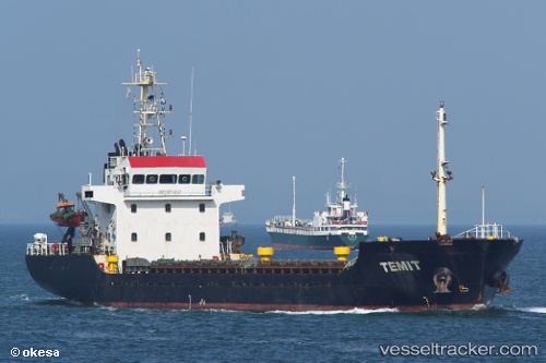
 TEMIT
TEMIT
Current Status
Where is the vessel?
TEMIT is currently in Near Dagu Bar, based on AIS data received less than 1h ago.
Latest AIS update:
Current position: 38.95478° N, 118.02676° E (Near Dagu Bar)
Average speed (last 7 days): Loading…
Average speed (last 30 days): Loading…
Vessel profile: TEMIT is a Cargo with dimensions m x m.
This page combines live AIS, route history, probable destination signals, nearby traffic, and port activity for practical vessel monitoring.
The current position of vessel TEMIT is 38.95478 lat / 118.02676 lng. Updated: 2026-04-30 19:59:38 UTCNearest reference points:
- Near Dagu Bar
- Near Tianjin Pt
- Near Taku Bar
Currently sailing under the flag of Sierra Leone ![]()
Details:
Live Vessel TEMIT Analytics (details, animations, etc.)
Recent AIS points (UTC):
2026-04-30 16:11:31 UTC · 38.95541, 118.02573 · SOG 0 kn · COG 166°2026-04-30 17:32:34 UTC · 38.95528, 118.02532 · SOG 0 kn · COG 139°
2026-04-30 19:32:37 UTC · 38.95488, 118.02670 · SOG 0 kn · COG 272°
2026-04-30 19:59:38 UTC · 38.95478, 118.02676 · SOG 0 kn · COG 283°