 vesseltracker.com
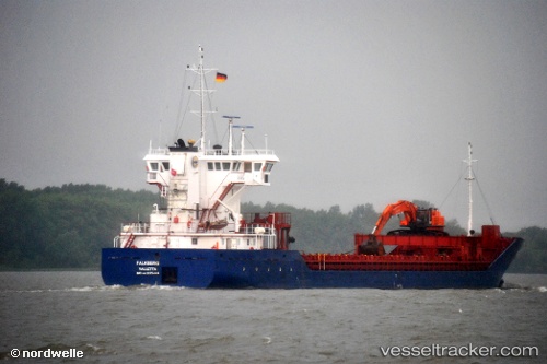
 TERNESKJAER
Current Status
Where is the vessel?
TERNESKJAER is currently in Near Glenelg, based on AIS data received less than 1h ago.
Latest AIS update:
Current position: 57.12719° N, 5.64016° W (Near Glenelg)
Average speed (last 7 days): Loading…
Average speed (last 30 days): Loading…
Vessel profile: TERNESKJAER is a General Cargo Ship with dimensions 14m x 82m.
This page combines live AIS, route history, probable destination signals, nearby traffic, and port activity for practical vessel monitoring.
The current position of vessel TERNESKJAER is 57.12719 lat / -5.64016 lng. Updated: 2026-05-15 10:06:31 UTCNearest reference points:
- Near KYLE OF LOCHALSH
- Near Fishnish, Isle of Mull
- Near Barcaldine
Currently sailing under the flag of Norway ![]()
TERNESKJAER built in 2008 year
Deadweight:
2900 tDetails:
Live Vessel TERNESKJAER Analytics (details, animations, etc.)
Recent AIS points (UTC):
2026-05-15 07:32:56 UTC · 57.26595, -5.67619 · SOG 0.1 kn · COG 261°2026-05-15 08:12:35 UTC · 57.24653, -5.64939 · SOG 11.1 kn · COG 209°
2026-05-15 09:26:45 UTC · 57.12497, -5.63483 · SOG 0.7 kn · COG 300°
2026-05-15 10:06:31 UTC · 57.12719, -5.64016 · SOG 5.5 kn · COG 317°