 vesseltracker.com
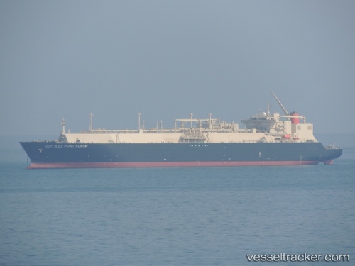
 Point Fortin
Current Status
Where is the vessel?
Point Fortin is currently in 113 nm E of Offshore Corpus Christi, based on AIS data received about 8h ago.
Latest AIS update:
Current position: 26.81315° N, 94.82953° W (113 nm E of Offshore Corpus Christi)
Average speed (last 7 days): Loading…
Average speed (last 30 days): Loading…
Vessel profile: Point Fortin is a Lng Tanker with dimensions 289m x 289m.
This page combines live AIS, route history, probable destination signals, nearby traffic, and port activity for practical vessel monitoring.
The current position of vessel Point Fortin is 26.81315 lat / -94.82953 lng. Updated: 2026-04-23 18:05:33 UTCNearest reference points:
- 63 nm SE of Quintana
- 56 nm SE of Quintana
- 49 nm SE of Sheppard
Currently sailing under the flag of Panama ![]()
Point Fortin built in 2010 year
Deadweight:
79592 tDetails:
Live Vessel Point Fortin Analytics (details, animations, etc.)
Recent AIS points (UTC):
2026-04-23 18:05:33 UTC · 26.81315, -94.82953 · SOG 15.3 kn · COG 116°2026-04-23 18:05:33 UTC · 26.81315, -94.82953 · SOG 15.3 kn · COG 116°
2026-04-23 18:05:33 UTC · 26.81315, -94.82953 · SOG 15.3 kn · COG 116°
2026-04-23 18:05:33 UTC · 26.81315, -94.82953 · SOG 15.3 kn · COG 116°