 vesseltracker.com
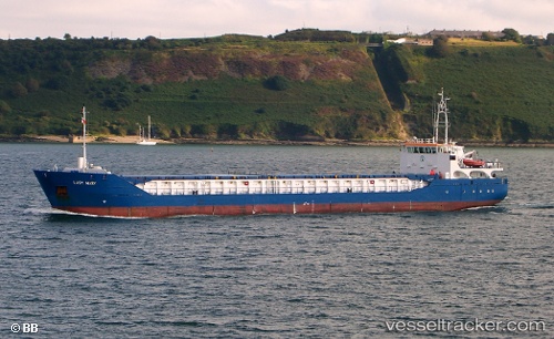
 Lady Mary
Current Status
Where is the vessel?
Lady Mary is currently in Near Tees River, based on AIS data received less than 1h ago.
Latest AIS update:
Current position: 54.69470° N, 1.01804° W (Near Tees River)
Average speed (last 7 days): Loading…
Average speed (last 30 days): Loading…
Vessel profile: Lady Mary is a Multi Purpose Carrier with dimensions 90m x 13m.
This page combines live AIS, route history, probable destination signals, nearby traffic, and port activity for practical vessel monitoring.
The current position of vessel Lady Mary is 54.69470 lat / -1.01804 lng. Updated: 2026-05-13 23:32:51 UTCNearest reference points:
- Near TYNE
- Near Blyth
- Near Hessle/Hull
Currently sailing under the flag of Antigua Barbuda ![]()
Lady Mary built in 2008 year
Deadweight:
3612 tDetails:
Live Vessel Lady Mary Analytics (details, animations, etc.)
Recent AIS points (UTC):
2026-05-13 19:39:43 UTC · 54.69471, -1.01865 · SOG 0.2 kn · COG 21°2026-05-13 22:08:49 UTC · 54.69465, -1.01886 · SOG 0.1 kn · COG 2°
2026-05-13 22:16:48 UTC · 54.69466, -1.01834 · SOG 0.4 kn · COG 1°
2026-05-13 23:32:51 UTC · 54.69470, -1.01804 · SOG 0.1 kn · COG 353°