 vesseltracker.com
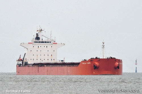
 Pelagic
Current Status
Where is the vessel?
Pelagic is currently in 51 nm SW of Cidade de Angra dos Reis FPSO, based on AIS data received about 1h ago.
Latest AIS update:
Current position: 25.90617° S, 43.67353° W (51 nm SW of Cidade de Angra dos Reis FPSO)
Average speed (last 7 days): Loading…
Average speed (last 30 days): Loading…
Vessel profile: Pelagic is a Bulk Carrier with dimensions 229m x 32m.
This page combines live AIS, route history, probable destination signals, nearby traffic, and port activity for practical vessel monitoring.
The current position of vessel Pelagic is -25.90617 lat / -43.67353 lng. Updated: 2026-05-13 23:38:00 UTCNearest reference points:
- 34 nm S of Cidade de Angra dos Reis FPSO
- 61 nm S of TEBIG
- 69 nm NE of Cidade de Angra dos Reis FPSO
Currently sailing under the flag of Liberia ![]()
Pelagic built in 2008 year
Deadweight:
83617 tDetails:
Live Vessel Pelagic Analytics (details, animations, etc.)
Recent AIS points (UTC):
2026-05-13 19:54:48 UTC · -25.58888, -44.23933 · SOG 9.4 kn · COG 123°2026-05-13 21:44:18 UTC · -25.74697, -43.95955 · SOG 9.6 kn · COG 130°
2026-05-13 22:33:58 UTC · -25.81747, -43.83508 · SOG 9.8 kn · COG 124°
2026-05-13 23:38:00 UTC · -25.90617, -43.67353 · SOG 9.4 kn · COG 125°