 vesseltracker.com
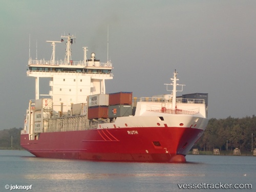
 Ruth
Ruth
Current Status
Where is the vessel?
Ruth is currently in 45 nm NW of Grampound, based on AIS data received about 1h ago.
Latest AIS update:
Current position: 51.15956° N, 5.99963° W (45 nm NW of Grampound)
Average speed (last 7 days): Loading…
Average speed (last 30 days): Loading…
Vessel profile: Ruth is a Container Ship with dimensions 134m x 22m.
This page combines live AIS, route history, probable destination signals, nearby traffic, and port activity for practical vessel monitoring.
The current position of vessel Ruth is 51.15956 lat / -5.99963 lng. Updated: 2026-05-14 19:51:58 UTCNearest reference points:
- 10 nm NW of Grampound
- 45 nm SE of Covent Garden
- Near WEXFORD
Currently sailing under the flag of Cyprus ![]()
Ruth built in 2008 year
Deadweight:
11253 tDetails:
Live Vessel Ruth Analytics (details, animations, etc.)
Recent AIS points (UTC):
2026-05-14 12:49:10 UTC · 52.78430, -5.64364 · SOG 16.2 kn · COG 188°2026-05-14 17:12:57 UTC · 51.76398, -5.94360 · SOG 13.6 kn · COG 194°
2026-05-14 19:10:27 UTC · 51.31857, -5.99499 · SOG 13.6 kn · COG 180°
2026-05-14 19:51:58 UTC · 51.15956, -5.99963 · SOG 14 kn · COG 178°