 vesseltracker.com
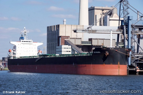
 Okinawa
Current Status
Where is the vessel?
Okinawa is currently in 142 nm E of Fort Dauphin, based on AIS data received less than 1h ago.
Latest AIS update:
Current position: 25.09770° S, 49.62674° E (142 nm E of Fort Dauphin)
Average speed (last 7 days): Loading…
Average speed (last 30 days): Loading…
Vessel profile: Okinawa is a Bulk Carrier with dimensions 225m x 32m.
This page combines live AIS, route history, probable destination signals, nearby traffic, and port activity for practical vessel monitoring.
The current position of vessel Okinawa is -25.09770 lat / 49.62674 lng. Updated: 2026-05-15 11:21:59 UTCNearest reference points:
- 271 nm E of Fort Dauphin
- 194 nm E of Manakara
- 209 nm E of Manakara
Currently sailing under the flag of Liberia ![]()
Okinawa built in 2009 year
Deadweight:
81397 tDetails:
Live Vessel Okinawa Analytics (details, animations, etc.)
Recent AIS points (UTC):
2026-05-15 08:27:21 UTC · -24.83833, 50.16792 · SOG 11.7 kn · COG 243°2026-05-15 10:03:11 UTC · -24.98540, 49.86957 · SOG 11.4 kn · COG 244°
2026-05-15 10:10:42 UTC · -24.99500, 49.84500 · SOG 11 kn · COG -1°
2026-05-15 11:21:59 UTC · -25.09770, 49.62674 · SOG 11.2 kn · COG 244°