 vesseltracker.com
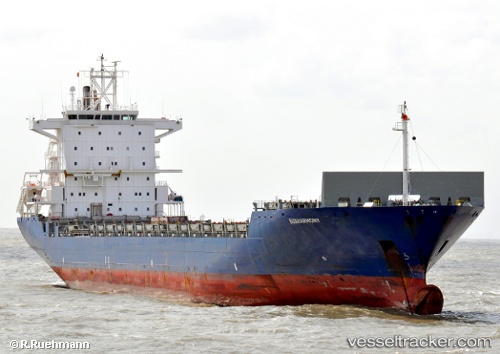
 CMA CGM SEMARANG
Current Status
Where is the vessel?
CMA CGM SEMARANG is currently in 59 nm E of Dar Es Salaam, based on AIS data received less than 1h ago.
Latest AIS update:
Current position: 6.73163° S, 40.26850° E (59 nm E of Dar Es Salaam)
Average speed (last 7 days): Loading…
Average speed (last 30 days): Loading…
Vessel profile: CMA CGM SEMARANG is a Container Ship with dimensions m x m.
This page combines live AIS, route history, probable destination signals, nearby traffic, and port activity for practical vessel monitoring.
The current position of vessel CMA CGM SEMARANG is -6.73163 lat / 40.26850 lng. Updated: 2026-05-14 06:14:29 UTCNearest reference points:
- Near Dar Es Salaam
Currently sailing under the flag of Malta ![]()
Details:
Live Vessel CMA CGM SEMARANG Analytics (details, animations, etc.)
Recent AIS points (UTC):
2026-05-14 02:55:21 UTC · -6.79812, 40.27555 · SOG 7.1 kn · COG 144°2026-05-14 04:01:40 UTC · -6.79449, 40.29727 · SOG 1.7 kn · COG 114°
2026-05-14 05:02:27 UTC · -6.76414, 40.28255 · SOG 1.9 kn · COG 86°
2026-05-14 06:14:29 UTC · -6.73163, 40.26850 · SOG 1.8 kn · COG 69°