 vesseltracker.com
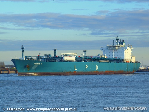
 George N
Current Status
Where is the vessel?
George N is currently in 239 nm NE of Marsh Harbour, based on AIS data received less than 1h ago.
Latest AIS update:
Current position: 28.16040° N, 72.87046° W (239 nm NE of Marsh Harbour)
Average speed (last 7 days): Loading…
Average speed (last 30 days): Loading…
Vessel profile: George N is a Lpg Tanker with dimensions 205m x 205m.
This page combines live AIS, route history, probable destination signals, nearby traffic, and port activity for practical vessel monitoring.
The current position of vessel George N is 28.16040 lat / -72.87046 lng. Updated: 2026-04-28 03:16:48 UTCCurrently sailing under the flag of Liberia ![]()
George N built in 2008 year
Deadweight:
43601 tDetails:
Live Vessel George N Analytics (details, animations, etc.)
Recent AIS points (UTC):
2026-04-27 23:40:36 UTC · 28.28014, -71.85281 · SOG 15.2 kn · COG 264°2026-04-28 01:39:43 UTC · 28.21232, -72.41280 · SOG 14.9 kn · COG 264°
2026-04-28 02:28:06 UTC · 28.19172, -72.63980 · SOG 15.1 kn · COG 264°
2026-04-28 03:16:48 UTC · 28.16040, -72.87046 · SOG 15.3 kn · COG 257°