 vesseltracker.com
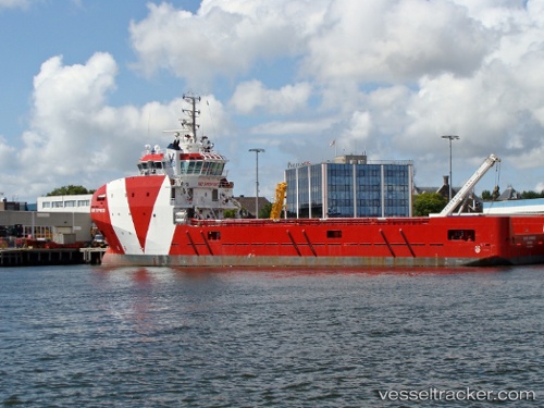
 BOS BASE
Current Status
Where is the vessel?
BOS BASE is currently in 12 nm W of Molengat, based on AIS data received about 1h ago.
Latest AIS update:
Current position: 53.05177° N, 4.31848° E (12 nm W of Molengat)
Average speed (last 7 days): Loading…
Average speed (last 30 days): Loading…
Vessel profile: BOS BASE is a Offshore Supply Ship with dimensions m x m.
This page combines live AIS, route history, probable destination signals, nearby traffic, and port activity for practical vessel monitoring.
The current position of vessel BOS BASE is 53.05177 lat / 4.31848 lng. Updated: 2026-05-15 01:15:45 UTCNearest reference points:
- Near Molengat
- Near Den Helder
- 22 nm W of Schoorl
Details:
Live Vessel BOS BASE Analytics (details, animations, etc.)
Recent AIS points (UTC):
2026-05-14 16:58:13 UTC · 53.67840, 3.42316 · SOG 6.1 kn · COG 147°2026-05-14 22:34:58 UTC · 53.26043, 3.98332 · SOG 5.1 kn · COG 117°
2026-05-14 23:55:35 UTC · 53.17359, 4.11715 · SOG 5.7 kn · COG 140°
2026-05-15 01:15:45 UTC · 53.05177, 4.31848 · SOG 5.7 kn · COG 136°