 vesseltracker.com
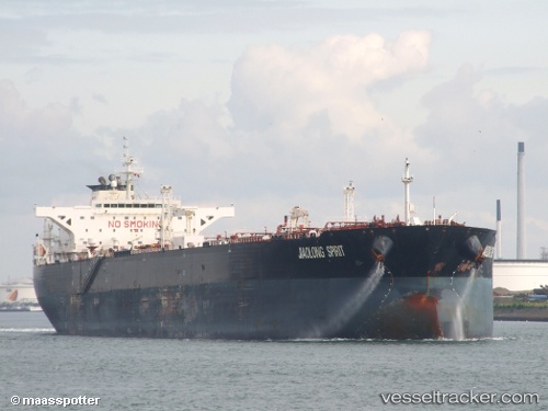
 JIAOLONG
Current Status
Where is the vessel?
JIAOLONG is currently in 108 nm SW of Keti Bandar, based on AIS data received less than 1h ago.
Latest AIS update:
Current position: 22.80921° N, 66.09354° E (108 nm SW of Keti Bandar)
Average speed (last 7 days): Loading…
Average speed (last 30 days): Loading…
Vessel profile: JIAOLONG is a Crude Oil Tanker with dimensions m x m.
This page combines live AIS, route history, probable destination signals, nearby traffic, and port activity for practical vessel monitoring.
The current position of vessel JIAOLONG is 22.80921 lat / 66.09354 lng. Updated: 2026-05-14 08:11:03 UTCNearest reference points:
- 84 nm SW of Keti Bandar
- 147 nm SW of Kiamari
- 16 nm S of Kiamari
Currently sailing under the flag of Liberia ![]()
Details:
Live Vessel JIAOLONG Analytics (details, animations, etc.)
Recent AIS points (UTC):
2026-05-14 04:44:33 UTC · 22.73944, 65.99629 · SOG 1.8 kn · COG 342°2026-05-14 06:01:42 UTC · 22.76597, 66.03173 · SOG 1.8 kn · COG 343°
2026-05-14 07:56:56 UTC · 22.80460, 66.08668 · SOG 2 kn · COG 355°
2026-05-14 08:11:03 UTC · 22.80921, 66.09354 · SOG 2 kn · COG 4°