 vesseltracker.com
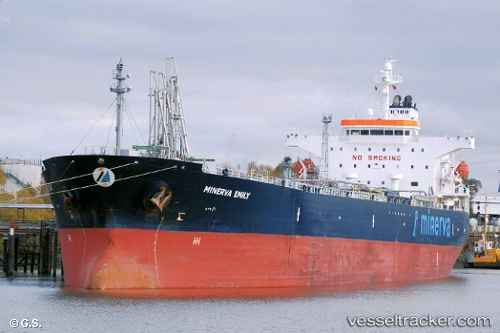
Minerva Emily
Current StatusWhere is the vessel?
Minerva Emily is currently in 125 nm W of Navarino Bay, based on AIS data received about 2h ago.
Latest AIS update:
Current position: 36.14837° N, 19.25430° E (125 nm W of Navarino Bay)
Average speed (last 7 days): Loading…
Average speed (last 30 days): Loading…
Vessel profile: Minerva Emily is a Crude Oil Tanker with dimensions 32m x 180m.
This page combines live AIS, route history, probable destination signals, nearby traffic, and port activity for practical vessel monitoring.
The current position of vessel Minerva Emily is 36.14837 lat / 19.25430 lng. Updated: 2026-04-02 23:56:54 UTCNearest reference points:
- 103 nm NE of Ryuo
- 71 nm N of Pinelands
- 73 nm N of Pinelands
Details:
Live Vessel Minerva Emily Analytics (details, animations, etc.)
Recent AIS points (UTC):
2026-04-02 17:24:30 UTC · 36.08633, 20.35130 · SOG 9 kn · COG -1°2026-04-02 19:20:44 UTC · 36.10870, 20.06575 · SOG 8.2 kn · COG 272°
2026-04-02 20:31:41 UTC · 36.12142, 19.84710 · SOG 7.9 kn · COG -1°
2026-04-02 23:56:54 UTC · 36.14837, 19.25430 · SOG 8.3 kn · COG -1°