 vesseltracker.com
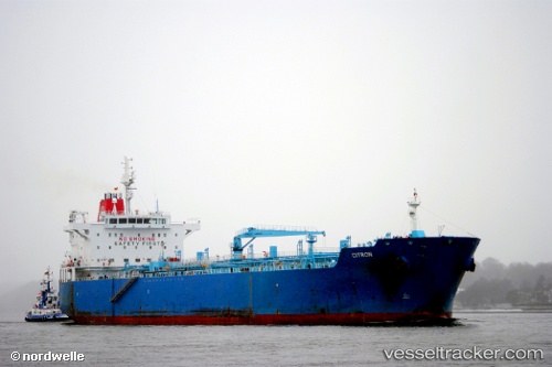
 LILA KINGSTON
Current Status
Where is the vessel?
LILA KINGSTON is currently in 91 nm N of Colomadu, based on AIS data received about 3h ago.
Latest AIS update:
Current position: 9.04553° N, 110.58338° E (91 nm N of Colomadu)
Average speed (last 7 days): Loading…
Average speed (last 30 days): Loading…
Vessel profile: LILA KINGSTON is a Oil/Chemical Tanker with dimensions m x m.
This page combines live AIS, route history, probable destination signals, nearby traffic, and port activity for practical vessel monitoring.
The current position of vessel LILA KINGSTON is 9.04553 lat / 110.58338 lng. Updated: 2026-05-15 07:08:08 UTCNearest reference points:
- 156 nm SE of Phan Rang-Tháp Chàm
- 163 nm E of Vinh Cam Ranh
- Near Rang Dong
Currently sailing under the flag of Liberia ![]()
Details:
Live Vessel LILA KINGSTON Analytics (details, animations, etc.)
Recent AIS points (UTC):
2026-05-14 19:05:22 UTC · 7.16047, 108.83716 · SOG 12.7 kn · COG 47°2026-05-15 07:08:08 UTC · 9.04553, 110.58338 · SOG 12 kn · COG 30°
2026-05-15 07:08:08 UTC · 9.04553, 110.58338 · SOG 12 kn · COG 30°
2026-05-15 07:08:08 UTC · 9.04553, 110.58338 · SOG 12 kn · COG 30°