 vesseltracker.com
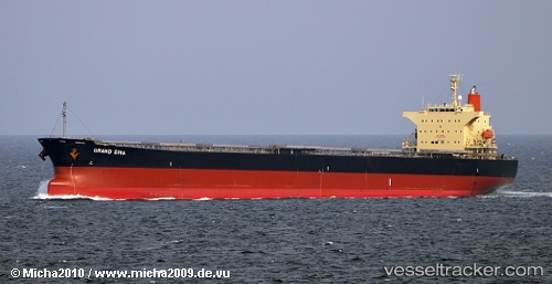
 BLUE IONIAN
Current Status
Where is the vessel?
BLUE IONIAN is currently in 136 nm N of Akpo, based on AIS data received about 1h ago.
Latest AIS update:
Current position: 0.86938° S, 60.82975° E (136 nm N of Akpo)
Average speed (last 7 days): Loading…
Average speed (last 30 days): Loading…
Vessel profile: BLUE IONIAN is a Bulk Carrier with dimensions 32m x 225m.
This page combines live AIS, route history, probable destination signals, nearby traffic, and port activity for practical vessel monitoring.
The current position of vessel BLUE IONIAN is -0.86938 lat / 60.82975 lng. Updated: 2026-04-23 10:42:21 UTCNearest reference points:
- 147 nm N of Akpo
Currently sailing under the flag of Marshall Islands ![]()
BLUE IONIAN built in 2007 year
Deadweight:
76596 tDetails:
Live Vessel BLUE IONIAN Analytics (details, animations, etc.)
Recent AIS points (UTC):
2026-04-23 07:38:42 UTC · -0.29520, 61.01522 · SOG 11.7 kn · COG 201°2026-04-23 07:53:59 UTC · -0.34253, 60.99800 · SOG 11.7 kn · COG 201°
2026-04-23 09:25:22 UTC · -0.62648, 60.90760 · SOG 11.8 kn · COG 199°
2026-04-23 10:42:21 UTC · -0.86938, 60.82975 · SOG 11.9 kn · COG 199°