 vesseltracker.com
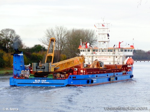
 BLUE SKY
Current Status
Where is the vessel?
BLUE SKY is currently in Near Marina di Ravenna, based on AIS data received about 1h ago.
Latest AIS update:
Current position: 44.46050° N, 12.26049° E (Near Marina di Ravenna)
Average speed (last 7 days): Loading…
Average speed (last 30 days): Loading…
Vessel profile: BLUE SKY is a Deck Cargo Ship with dimensions 92m x 24m.
This page combines live AIS, route history, probable destination signals, nearby traffic, and port activity for practical vessel monitoring.
The current position of vessel BLUE SKY is 44.46050 lat / 12.26049 lng. Updated: 2026-05-16 10:00:47 UTCNearest reference points:
- Near Marina di Ravenna
- Near Porto San Vitale
- Near San Giuseppe
Currently sailing under the flag of Palau (Republic of) ![]()
BLUE SKY built in 2006 year
Deadweight:
5664 tDetails:
Live Vessel BLUE SKY Analytics (details, animations, etc.)
Recent AIS points (UTC):
2026-05-16 07:30:20 UTC · 44.46039, 12.26052 · SOG 0 kn · COG 109°2026-05-16 07:42:20 UTC · 44.46038, 12.26047 · SOG 0 kn · COG 109°
2026-05-16 09:33:20 UTC · 44.46043, 12.26047 · SOG 0 kn · COG 109°
2026-05-16 10:00:47 UTC · 44.46050, 12.26049 · SOG 0 kn · COG 108°