 vesseltracker.com
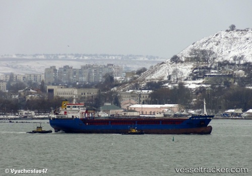
 NACI SELIMOGLU
Current Status
Where is the vessel?
NACI SELIMOGLU is currently in Near Naples, based on AIS data received less than 1h ago.
Latest AIS update:
Current position: 40.84107° N, 14.28161° E (Near Naples)
Average speed (last 7 days): Loading…
Average speed (last 30 days): Loading…
Vessel profile: NACI SELIMOGLU is a General Cargo Ship with dimensions 92m x 15m.
This page combines live AIS, route history, probable destination signals, nearby traffic, and port activity for practical vessel monitoring.
The current position of vessel NACI SELIMOGLU is 40.84107 lat / 14.28161 lng. Updated: 2026-04-24 03:50:47 UTCNearest reference points:
- Near Naples
- Near MERGELLINA
- Near Castellammare di Stabia
Currently sailing under the flag of Barbados ![]()
NACI SELIMOGLU built in 2007 year
Deadweight:
5229 tDetails:
Live Vessel NACI SELIMOGLU Analytics (details, animations, etc.)
Recent AIS points (UTC):
2026-04-24 00:02:41 UTC · 40.84107, 14.28162 · SOG 0 kn · COG 195°2026-04-24 01:17:42 UTC · 40.84108, 14.28163 · SOG 0 kn · COG 195°
2026-04-24 01:53:46 UTC · 40.84110, 14.28161 · SOG 0 kn · COG 195°
2026-04-24 03:50:47 UTC · 40.84107, 14.28161 · SOG 0 kn · COG 195°