 vesseltracker.com
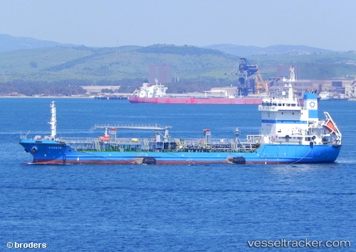
 KASSOS
Current Status
Where is the vessel?
KASSOS is currently in Near TANGER MED, based on AIS data received less than 1h ago.
Latest AIS update:
Current position: 35.95679° N, 5.45448° W (Near TANGER MED)
Average speed (last 7 days): Loading…
Average speed (last 30 days): Loading…
Vessel profile: KASSOS is a Oil Products Tanker with dimensions m x m.
This page combines live AIS, route history, probable destination signals, nearby traffic, and port activity for practical vessel monitoring.
The current position of vessel KASSOS is 35.95679 lat / -5.45448 lng. Updated: 2026-05-14 03:24:18 UTCNearest reference points:
- Near TANGER MED
- Near Algeciras
- Near TARIFA
Details:
Live Vessel KASSOS Analytics (details, animations, etc.)
Recent AIS points (UTC):
2026-05-13 23:31:40 UTC · 35.89647, -5.49986 · SOG 0 kn · COG 50°2026-05-14 01:31:37 UTC · 35.89652, -5.49987 · SOG 0 kn · COG 50°
2026-05-14 01:49:43 UTC · 35.89650, -5.49986 · SOG 0 kn · COG 51°
2026-05-14 03:24:18 UTC · 35.95679, -5.45448 · SOG 14.9 kn · COG 45°