 vesseltracker.com
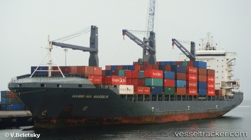
Sealand Manzanillo
Current StatusWhere is the vessel?
Sealand Manzanillo is currently in Near Acajutla, based on AIS data received less than 1h ago.
Latest AIS update:
Current position: 13.57546° N, 89.84036° W (Near Acajutla)
Average speed (last 7 days): Loading…
Average speed (last 30 days): Loading…
Vessel profile: Sealand Manzanillo is a Container Ship with dimensions 30m x 200m.
This page combines live AIS, route history, probable destination signals, nearby traffic, and port activity for practical vessel monitoring.
The current position of vessel Sealand Manzanillo is 13.57546 lat / -89.84036 lng. Updated: 2026-05-14 21:48:49 UTCNearest reference points:
- Near San Jose
- Near El Salvador
- 14 nm NW of Puerto Cortes
Details:
Live Vessel Sealand Manzanillo Analytics (details, animations, etc.)
Recent AIS points (UTC):
2026-05-14 18:03:47 UTC · 13.57546, -89.84037 · SOG 0 kn · COG 124°2026-05-14 19:36:47 UTC · 13.57546, -89.84037 · SOG 0 kn · COG 123°
2026-05-14 19:42:47 UTC · 13.57546, -89.84037 · SOG 0 kn · COG 123°
2026-05-14 21:48:49 UTC · 13.57546, -89.84036 · SOG 0.1 kn · COG 124°