 vesseltracker.com
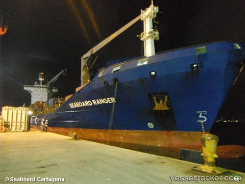
 SEABOARD RANGER
Current Status
Where is the vessel?
SEABOARD RANGER is currently in 88 nm S of Fond-des-Blancs, based on AIS data received about 3h ago.
Latest AIS update:
Current position: 16.81342° N, 73.06575° W (88 nm S of Fond-des-Blancs)
Average speed (last 7 days): Loading…
Average speed (last 30 days): Loading…
Vessel profile: SEABOARD RANGER is a General Cargo with dimensions m x m.
This page combines live AIS, route history, probable destination signals, nearby traffic, and port activity for practical vessel monitoring.
The current position of vessel SEABOARD RANGER is 16.81342 lat / -73.06575 lng. Updated: 2026-04-25 19:04:41 UTCCurrently sailing under the flag of Liberia ![]()
Details:
Live Vessel SEABOARD RANGER Analytics (details, animations, etc.)
Recent AIS points (UTC):
2026-04-25 16:02:47 UTC · 16.56667, -72.15333 · SOG 18 kn · COG -1°2026-04-25 17:20:57 UTC · 16.66833, -72.54500 · SOG 18 kn · COG -1°
2026-04-25 18:42:06 UTC · 16.78167, -72.95333 · SOG 18 kn · COG -1°
2026-04-25 19:04:41 UTC · 16.81342, -73.06575 · SOG 17.5 kn · COG 286°